GEOID has just expanded their Bike Computer range with the introduction of the CC600 Smart GPS Bike Computer. In this post, we’ll be giving you an initial overview of both the hardware and software, followed by our first test ride with the device.
From the specifications and images, the device appears to be a rebranded version of the Magene C506 SE.
Specifications


| Screen size | 2.4 inch |
| Screen type | full-laminated color screen (no touch) |
| Screen backlight | Automatic backlight with ambient light sensor |
| Size | 78 x 48 x 17.5mm |
| Weight | 74g |
| Buttons | 3 (Power, Menu/Page, Pause/Stop) |
| Number of data pages | 10 |
| Number of displayed data items on a page | 10 |
| Waterproof | IPX7 |
| Battery life | 17 hours in daily mode and up to 24 hours in extended battery mode (depending on usage scenario and custom settings) |
| Charging port | USB Type-C |
| Wireless protocols | WiFi, Bluetooth and ANT+ |
| Storage | 100 hours |
| Supported Sensors | Speed, Cadence, Heart rate, Power meter, Smart trainer, Electronic shifting (No Remote Control), Radar, Tail and Front Light |
| Languages | English, Spanish, Portuguese, German, French, Italian, Polish, Traditional Chinese, Korean, Japanese, Russian |
| Positioning systems | BeiDou, GPS, GLONASS, QZSS and Galileo |
| Data exporting | STRAVA, TrainingPeaks, Decathlon and FIT File |
Box contents


First time setup
When you power on the device, the first screen you’ll see is the language selection. Once you choose your preferred language, the device will prompt you to pair it with the OneLap Fit App. You can skip this step and pair your phone later from the settings menu if you prefer. After the pairing page, the initial setup is complete. You can then head to the settings page to connect your ANT+ and Bluetooth Smart sensors, as we did, or jump straight into a ride.


Configuration and customization

Unfortunately, the customization and configuration options directly on the device are quite limited, largely due to its three-button design. To customize or add new data pages, export tracks, or use the navigation features, you’ll need to pair the bike computer with the OneLap Fit app.
Let’s explore the customization, configuration, and navigation options together:


After experimenting with the app for a bit, I found that the built-in Quick Navigation and route planner didn’t provide satisfactory results. Many popular bike paths were missing, and it would often direct you onto main roads that aren’t suitable for cyclists. As a result, I opted to import a GPX track from Komoot.


You can also enable WiFi connectivity for the bike computer through the app and manually trigger a data retransmission if syncing fails. The general settings tab is where you can switch between your bikes, which is essential if you’re using a speed sensor that requires the correct wheel circumference. Unfortunately, you cannot switch bikes directly on the device.
Finally, you can modify general function settings such as auto-off, auto-screen-off, auto-pause, auto-lap, and unit preferences within the function settings.


Regarding data page customization, there’s one outdoor profile and three indoor trainer profiles: target power, resistance, and grade category. You can create up to 10 data pages, each with 10 fields. The graphical fields require either 2×3, 2×2, or at least 2×1 layouts, but the gauges are only available in a 2×3 format, limiting you to one gauge per page. A few additional layout options would be beneficial as well.
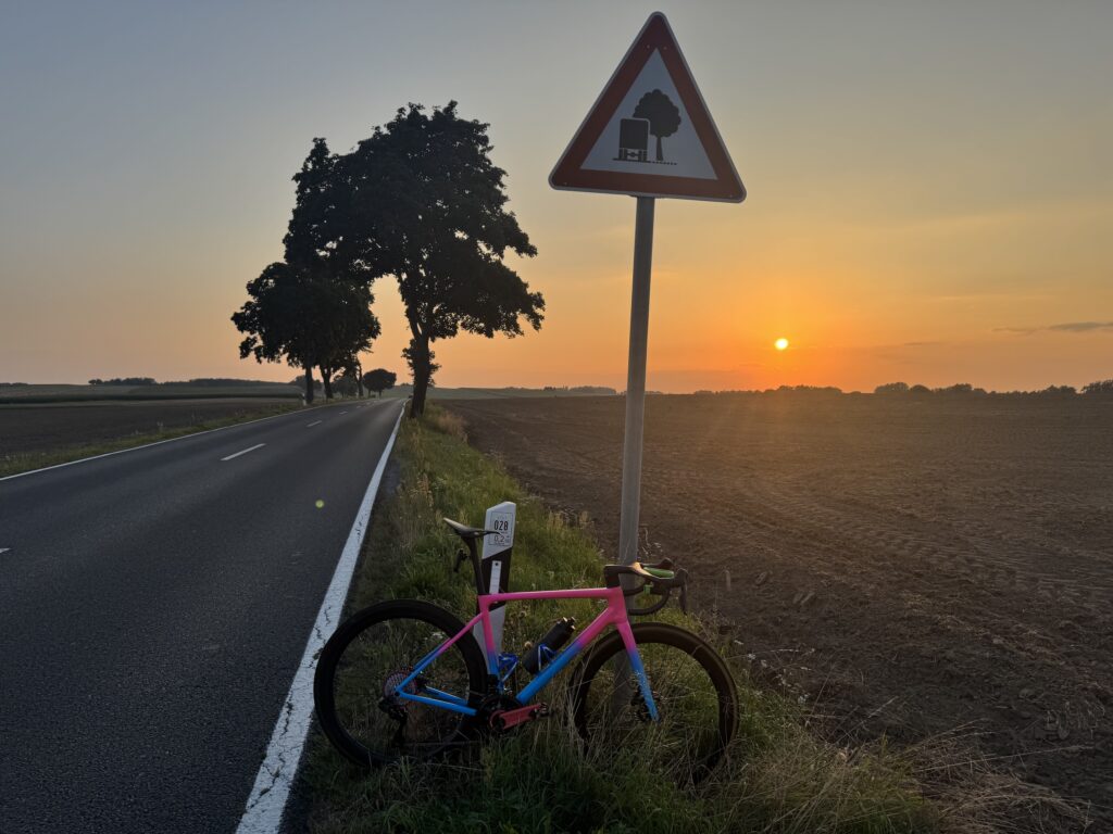
Getting out on the bike
After pairing all my ANT+ sensors, including the Ultegra Di2, Magene P505 Power Meter, Magene S314 Speed Sensor, Magene H603 Heart Rate Monitor Strap, and Magene L508 Smart Radar Taillight, I planned a route using Komoot and imported it through the OneLap Fit App. It was then time for a test ride. My primary focus was on the usability of the core features, specifically the data view and navigation capabilities:
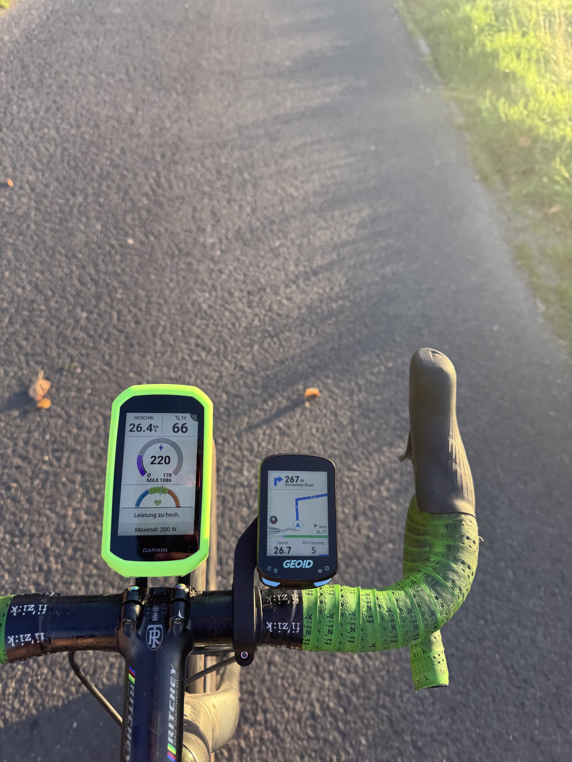
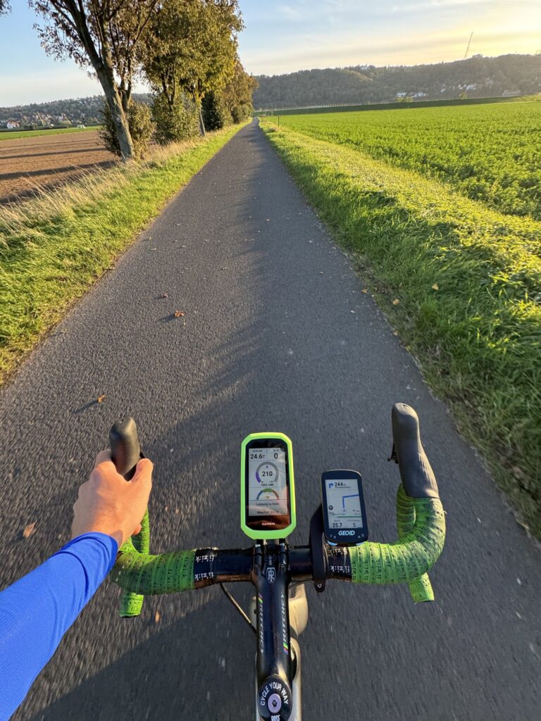
While navigating the data pages, the first thing I noticed is that you can only move in one direction, from left to right, by pressing the bottom left button. This means that if you have 10 data pages plus navigation, you’ll need to press the button 10 times to return to a previous page after an accidental press. Consequently, having 10 data pages on this device may not be practical. It would be beneficial to have the option to remap the buttons so that you can navigate in both directions. Additionally, while pairing the Ultegra Di2 was successful, the computer does not support the D-Fly protocol, which would allow for navigation through the pages using the hood buttons.


Next, let’s explore the ANT+ radar support feature. Unlike the Garmin, the GEOID unit consistently displays the radar bar on the left side, always showing the little gray arrows. When one or more cars are approaching, the arrows will change to orange or red based on their speed, with dangerously fast approaches highlighted in red. Additionally, the unit emits a beep by default when it detects an approaching vehicle.
The adjacent picture already highlights another limitation of the device: its pseudo-map support, as many roads, including major ones, are not displayed.
Unlike the Garmin, this device does not automatically switch to the maps data page when a turn is required. However, it does provide a small pop-up with directions a few hundred meters before the turn. Overall, the navigation was mostly consistent with Garmin, though it failed to recognize some necessary turns. While it supports re-routing when connected to the OneLap Fit app, this feature did not work during my testing.
Overall the device does not offer real navigation with maps, only turn-by turn track following.

Viewing and exporting the ride data
Once you’ve finished your ride, the GEOID CC600 will provide a summary of your activity, as shown in the following gallery:


For additional analysis and sharing, you can use the OneLap Fit App directly or export your data to Strava, TrainingPeaks, or Decathlon. Alternatively, you can export the FIT file and upload it to a platform or tool of your choice. It does not offer automatic FTP or maximum HR detection, you have to manually set your FTP and HR in the OneLap Fit App.


Final Thoughts
| What is good | + Broad ANT+ and BLE Sensor Connectivity + Importing and following GPX Tracks + Radar Vehicle Alerts + Exporting to Strava, TrainingPeaks and FIT-File |
| Shortcomings | – Unusable Quick navigation and route-planner – Turn-by-turn navigation misses turns sometimes – Missing streets on the map – No D-Fly support – One-directional data page navigation |

Overall, the GEOID CC600 is an impressive cycling computer within its category. It offers excellent connectivity, customizable data pages, and GPX track following with turn-by-turn navigation for under €50. If you don’t require advanced features like ClimbPro, Automatic FTP Detection, and built-in navigation found in pricier models like the Garmin Edge 1050, and your primary focus is on following planned routes and tracking ride data, then this is the ideal computer for you.
Leave a Reply